Topics to Raise in a Comment on the Villiers Island Development Application
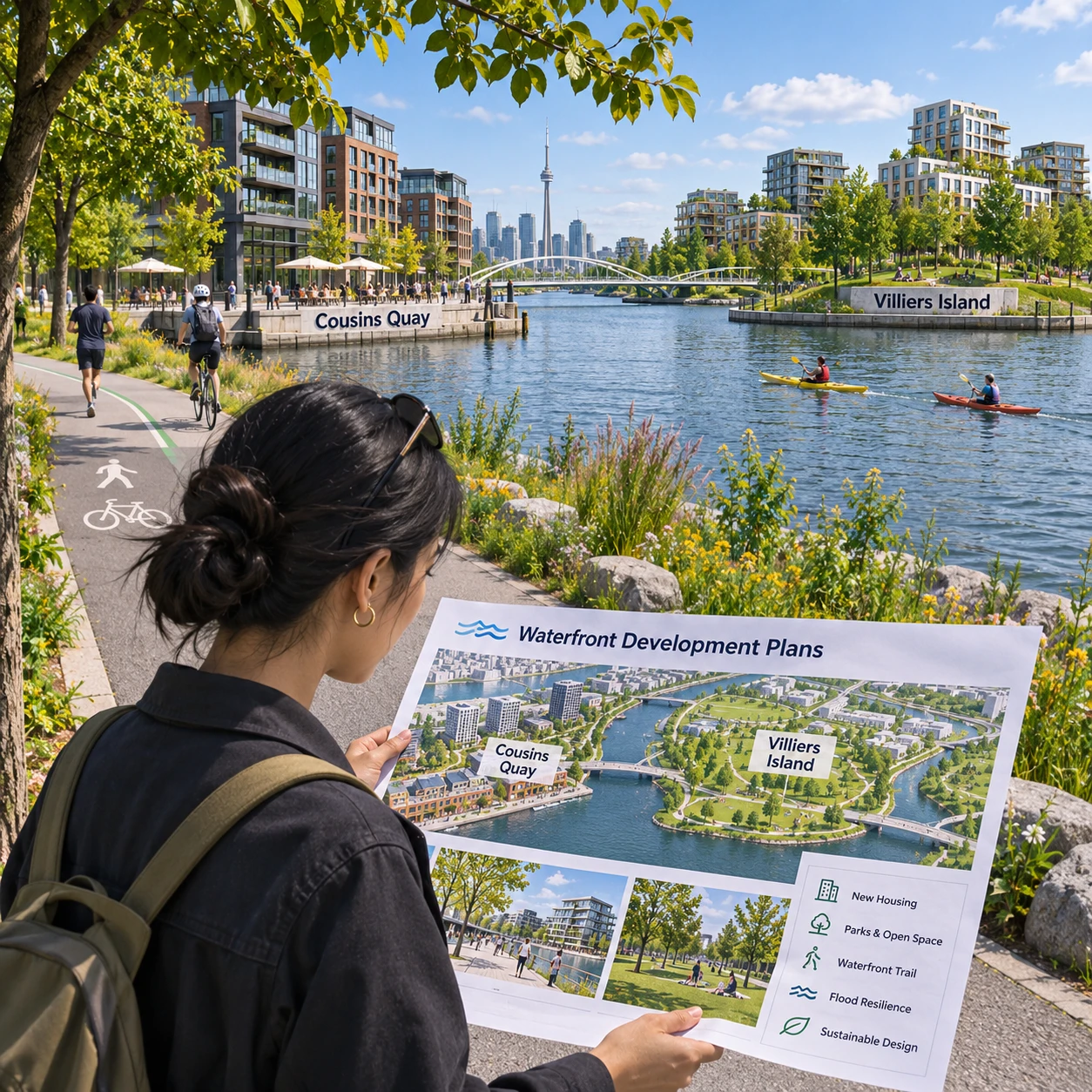
A development application can affect more than the buildings shown on a plan. On Villiers Island, its relationship to flood protection, Cousins Quay and the waterfront trail may shape how people experience the shoreline and move through the area.
If you are preparing a community comment, focus on the application’s actual plans and explain what you support, question or would like clarified. The topics below can help you make a locally relevant submission without assuming details that may not appear in the application.
Start with the application and its local context
First, identify the specific development application and the parts of Villiers Island it could affect. A useful comment names a plan feature or proposed relationship to nearby places, then explains why it matters to you.
Before writing, review the application notice and available drawings, planning documents and supporting reports. Confirm the site location, the proposal’s scope and which materials are current. If the plans refer to Cousins Quay, the waterfront trail or flood-protection works, use those terms accurately; avoid treating a nearby project or an earlier design as part of the application unless the documents establish that connection.
It can help to make a quick evidence note as you read:
- What the application shows: for example, a building edge, open space, route or connection to the waterfront.
- What is unclear: a missing dimension, an ambiguous public route or a connection whose timing is not explained.
- Why it matters locally: how the feature could affect access, safety, flood resilience or everyday use.
This approach keeps your comment tied to the proposal rather than making broad claims about waterfront planning. If you cannot verify a detail, frame it as a question: ask the applicant or decision-makers to clarify it.
Flood protection and resilience
Comments about flood protection are most useful when they ask how the development relates to the relevant protective measures and waterfront conditions. Focus on the plans and information provided, and request clarification where a connection is not clear.
Villiers Island’s waterfront setting makes resilience a practical planning concern. Look for information on how the proposal meets or coordinates with flood-protection infrastructure, how the shoreline edge is designed, and whether buildings, open spaces and routes remain usable under the conditions described in the application materials. Do not assume a particular flood standard or that a feature is included; refer to the documents, and ask for the source or design basis when needed.
Questions you might raise include:
- How does the development connect to the flood-protection approach shown for the site?
- Are the relationship between the building, public realm and waterfront edge clear in the drawings?
- Do the plans explain how access routes and public spaces are considered in relation to waterfront conditions?
- Where responsibilities or construction phases involve more than one project, how will coordination be maintained?
- What information is available about inspection, maintenance and long-term operation of relevant protective features?
Keep the distinction between a design question and a technical conclusion clear. A resident can identify a concern or request evidence without claiming that the development will cause flooding. For example: “The submitted plans do not make clear how the public route meets the shoreline protection. Please clarify the connection and how it will remain accessible.”
Cousins Quay and public waterfront access
For Cousins Quay, consider whether the application explains how people can reach, move through and comfortably use the waterfront. Public access includes the route to the quay as well as the quality and continuity of the spaces people encounter there.
Review the drawings for entrances, paths, crossings, changes in level, seating areas and transitions between the development and the quay. Check whether a route appears to be public, how it connects to surrounding streets and open spaces, and whether the documents explain any access limits. A line on a site plan may indicate a connection, but not show how legible or convenient it will feel on the ground.
Consider asking:
- Is the route to Cousins Quay clear from nearby streets and public spaces?
- Does the design show places to pause, sit or enjoy the waterfront, where appropriate?
- Are changes in level and access for people with mobility needs addressed in the submitted information?
- Will public access remain understandable if adjacent spaces have different owners or operating arrangements?
- Does the waterfront design balance public use with safety, servicing and the needs of nearby residents?
Specificity matters. Instead of saying “make the quay more welcoming,” identify a location or design choice: “Please show how the path from the site entrance connects to Cousins Quay and whether the route is step-free.” This gives the review team a concrete issue to assess. It also leaves room for design trade-offs: more public activity can make a waterfront feel lively, while circulation, quiet and safety still need attention.
The waterfront trail
When commenting on the waterfront trail, look at continuity, safety, accessibility and connections to destinations around Villiers Island. A useful comment points to where the route works, where it is uncertain or what information is missing.
Trace the trail through the application area on the plans. Does it connect clearly with nearby paths and public spaces? Do drawings show how people walking, cycling or using mobility devices share or cross routes? Consider sightlines, lighting, wayfinding and places where people may need to cross vehicle or service movements, if those features are shown. Avoid asserting that a conflict exists unless the plans or your direct experience support that concern.
Also check whether the trail’s relationship to flood protection and Cousins Quay is explained. A route can be continuous on paper but difficult to use if its entrances are hard to find, its connections are indirect, or the interface with the shoreline is unclear. Ask for details about any proposed interruption, detour or phased connection if the application documents raise one.
You might write: “Please clarify how the waterfront trail connects to the route beside Cousins Quay, including accessible transitions and any crossing points shown in the plans.” If you have visited the area, briefly describe what you observed and when. Personal observations can add context, but distinguish them from information confirmed by the application.
Turning concerns into useful comments
A useful development application comment identifies a specific feature, explains its local effect and makes a clear request. This simple structure keeps feedback respectful, relevant and easier to evaluate.
Try the feature–impact–request format:
- Feature: Name the drawing, route, edge or public space you are discussing.
- Impact: Explain the practical consequence or concern, such as unclear access or an unanswered resilience question.
- Request: Ask for a clarification, design change, additional detail or condition for consideration.
For example: “The site plan shows a path toward the waterfront, but it is not clear how it connects to the trail near Cousins Quay. Please clarify the connection and show whether it is accessible without steps.” That comment is more actionable than a general statement that the proposal is good or bad.
Keep each point focused, use neutral language and separate facts from questions. You can support a proposal feature while asking for revisions to another. Avoid repeating the same concern in several forms; a short, well-supported comment is often easier to follow than a long list of unrelated claims. If you refer to a page, drawing or report, identify it so readers can check the same information.
How to submit a comment
To submit a comment, follow the instructions published for the specific development application. Confirm the deadline, accepted submission methods and any required information before sending your feedback.
Application procedures can differ, so do not rely on a general guide or an older notice. Check the current application notice and the responsible authority’s official materials for the correct contact details, file or reference number, format requirements and submission options. If the instructions are unclear, contact the listed planning office before the deadline rather than guessing where to send a comment.
Before submitting, check that your comment:
- Identifies the application or site clearly.
- Addresses a feature relevant to the proposal, such as flood protection, Cousins Quay, public access or the waterfront trail.
- States the concern, support or question in plain language.
- Includes a specific request where possible.
- Follows the application’s instructions and arrives by the stated deadline.
Save a copy of your submission and any confirmation you receive. If you want to discuss multiple issues, organize them under short headings so each point can be reviewed separately. The aim is to provide clear community comments that help decision-makers understand how the proposed development relates to Villiers Island and its waterfront.
Frequently asked questions
What topics can I comment on in a development application?
You can comment on features relevant to the specific proposal, including its relationship to flood protection, Cousins Quay, public access, waterfront design and the trail. Check the application materials to keep your points within scope.
How can I make my comment specific and useful?
Name the plan feature, explain its effect or what remains unclear, and make a practical request. Referring to a drawing, location or route helps connect your feedback to the application.
Where can I find the submission instructions and deadline?
Use the current notice and official application materials for the correct deadline, accepted methods and contact details. Requirements may vary by application, so verify them directly.
Can I raise concerns about flood protection or public access?
Yes, if your concerns relate to the application. Ask specific questions about the information provided and avoid presenting unverified assumptions as established facts.